
Breaking News
Snowstorm updates. Latest forecast on this weekend’s icy winter storm.
More than half of the United States is bracing for a massive winter storm bringing a combination of snow, ice and frigid weather to nearly everyone east of the Rockies, which forecasters warn could knock out power and snarl travel for days.
By Thursday, around 180 million people were under some kind of winter weather advisory, watch or warning, said Brian Hurley, meteorologist at the National Weather Service Weather Prediction Center.
The storm is expected to start on Friday and stretch into the weekend, spreading snow and ice from the southern Plains to the Northeast, according to forecasters. The weather service said the system is expected to move across the East Coast through the weekend and could cause “catastrophic ice accumulation.”
Which states will be hit hardest?
While snow is expected all the way from the Southwest to the Northeast, and everywhere in between, AccuWeather meteorologist Bob Larson told USA TODAY there is potential for portions of Pennsylvania, Maryland, West Virginia, and Virginia to receive up to 24 inches of snow or more.
“This will be a large and potentially historic storm, with major impacts over a very large area (more than 2 dozen states),” he said, noting that “the greatest risk of a major ice storm will extend from Texas to the Carolinas.”
The weather service warned of “treacherous travel conditions, prolonged power outages, and tree damage,” across the southern Plains, Lower Mississippi Valley, Mid-South, and the Carolinas. Local officials in these areas have urged residents to avoid traveling and prepare for possible power outages.
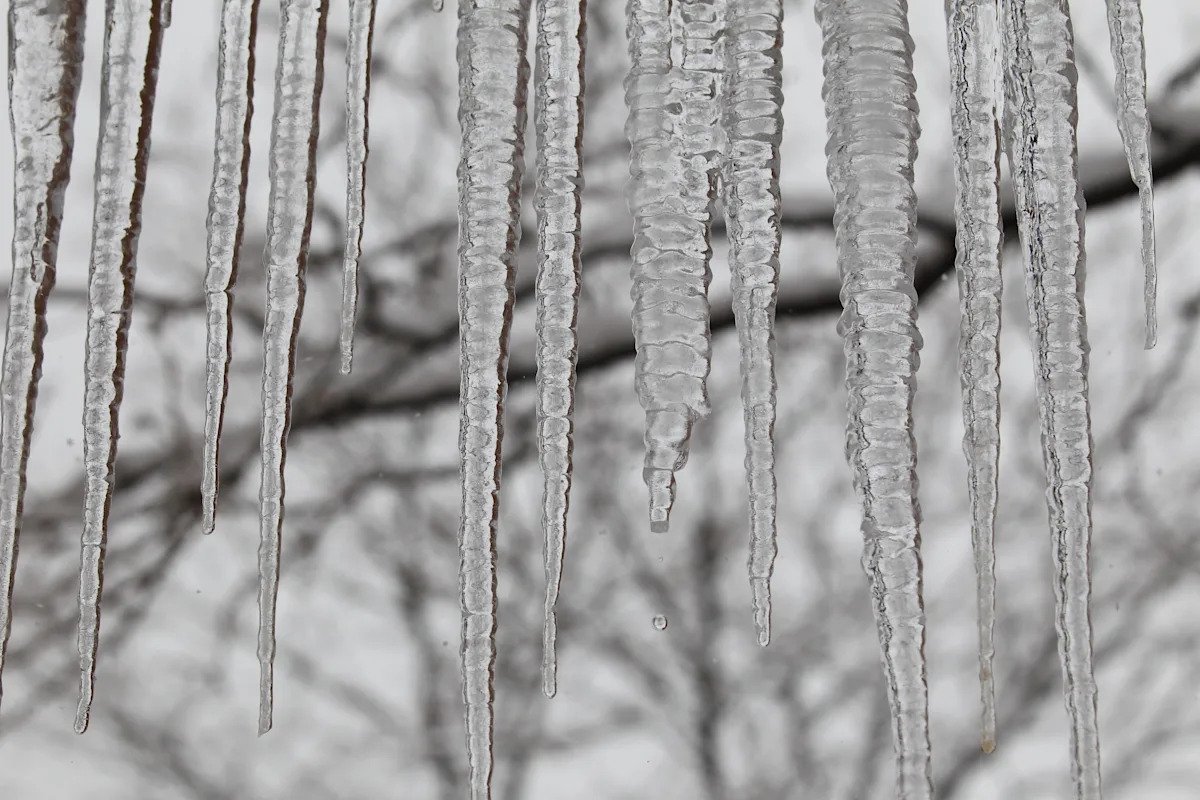
Ice is a serious concern as storm looms
Among all the warnings and advisories, one of the big concerns is the ice that will arrive in the form of freezing rain or sleet, said Hurley, a weather service meteorologist. “The ice is more damaging than the snow.”
“A lot of places are expected to get at least a quarter-inch, and that’s dangerous in terms of trees, powerlines and driving,” he said. “Some areas are probably going to get over a half-inch and some maybe even more than that.”
Two primary corridors of ice are forecast to form, Hurley said. One will form from Texas, northern Louisiana and southern Arkansas, working up into northern Mississippi and south of Nashville. A second corridor will form from Northeast Georgia, through Upstate South Carolina and into parts of North Carolina and Virginia.
How does the polar vortex work? Maps show why frigid temps are expected to blast much of the US
What time will the winter storm start?
In the west, severe weather is expected to arrive in Texas late on Friday afternoon, then move into the lower Mississippi River Valley.
East of the Mississippi River, storm activity will start on Saturday morning and spread across the region, extending through Sunday.
In the mid-Atlantic states, the storm is expected to start on Saturday night and extend through Sunday.
Temperatures plunging in Midwest region
By 6 p.m. local time in the Aberdeen, South Dakota, weather service region on Thursday, a few locations already were experiencing wind chills colder than 40 below. The weather service reported wind chills of minus 45 in Hillhead and a minus 46 in Summit, as well as a minus 41 in Traverse, Minnesota.
The region’s coldest wind chills are expected overnight and daytime high temperatures on Friday could break record lows in some locations, including Aberdeen and Pierre, a weather service advisory said. It advised people to “avoid going outdoors where possible.”
Depending on wind speeds and temperatures, wind chill values in the region could drop another 4 to 7 degrees through 6 or 7 a.m. local time on Friday morning, said Aaron Dorn, a weather service meteorologist in Aberdeen.
The lowest temperature on Thursday in the United States was minus 29 in Bottineau, North Dakota, while folks in tiny Ochopee, Florida, saw a high of 86.
Get prepared: What should you do if you lose power during an ice storm?
‘Pretty significant swath of heavy ice’
More than 200 million people are under advisories related to the storm, said Frank Pereira, a meteorologist at the weather prediction center. That includes more than 175 million people under some kind of winter weather watch, warning, or advisory.
On Thursday evening, the weather service issued an ice storm warning for portions of southeastern Arkansas, northeastern Louisiana, northern Alabama, northern Georgia, and north Mississippi and west Tennessee. “There’s going to be a pretty significant swath of heavy ice,” Pereira said.
Delays and cancellations begin, from travel to deliveries
Air carriers and delivery services began warning Thursday afternoon of flight cancellations and slowdowns.
Delta Airlines announced that due to expected snow and ice, flight cancellations for safety would be necessary at select airports in North Texas, Oklahoma, Arkansas, Louisiana, and Tennessee. The airline encouraged customers to verify their flight status before visiting airports.
Amazon posted a notice on its website Thursday, warning customers that “Some deliveries may take longer than usual due to winter storms,” the company said.
What’s the difference between a watch and a warning?
Extreme cold watch – Issued when extremely dangerous cold conditions or wind chill values are possible, but the occurrence, location, and/or timing is still uncertain.
Winter storm warning – A significant combination of hazardous winter weather is occurring or imminent.
Winter storm watch – A potential for significant and hazardous winter weather exists within 48 hours.
Winter weather advisory – Issued for any amount of freezing rain or when 2 to 4 inches of snow, alone or in combination with other precipitation, is expected to cause a significant inconvenience.
How much snow will fall?
An expansive area of the country will see more than 6 inches of snow, Hurley said. For many areas, it’s going to be 6 to 15 inches, the meteorologist at the weather prediction center explained.
In the higher terrain areas of northwest Virginia, the Appalachians and north-central Maryland, “we are going to see more areas of 10 to 15 inches of snow,” Hurley said. Snow totals that are at 18 inches or over will be “more spotty and tied to higher terrain.”
In the western Virginia mountains, and up into the Poconos, there will be areas that get 18 to 20 inches, Hurley said. Higher snow totals also are expected in New England.

More than 175 million people are under at least one kind of winter weather advisory from the National Weather Service and its Weather Prediction Center as more than half the nation braces for a winter storm that will begin arriving in the west on Friday afternoon.
Governors call states of emergency as storm looms
Governors from at least 14 states have issued disaster or emergency declarations as the potentially life-threatening storm looms. The states include Texas, Georgia, South Carolina, North Carolina, Virginia, West Virginia, Maryland, Louisiana, Arkansas, Tennessee, Alabama, Mississippi, Oklahoma, and Missouri.
On Thursday, Georgia Gov. Brian Kemp declared a statewide emergency, which would allow for up to 500 Georgia National Guard troops to be deployed for storm preparation, response, and recovery. Most of the storm’s impacts across the state will be in the form of freezing rain, the governor’s office said.
Arkansas Gov. Sarah Huckabee Sanders declared an emergency that directs up to $250,000 for storm response.
Maryland Gov. Wes Moore and West Virginia Gov. Patrick Morrisey have declared states of “preparedness.” In Alabama, Gov. Kay Ivey signed a proclamation Thursday issuing a state of emergency for 19 northern counties.
Texas governor declares disaster ahead of storm, says power grid is strong
Texas Gov. Greg Abbott on Thursday issued a disaster declaration ahead of the storm, which he said would bring “ultra-cold temperatures” and dangerous road conditions. The northern-most two-thirds of the state will be the hardest hit, he said.
“Because of the severity of this storm, right now I am making a disaster declaration covering 134 counties across the state of Texas to make sure that every possible resource can be made available them so they can respond quicker, faster and better,” Abbott said at a news conference.
Abbott urged Texans to begin their preparations right away for the storm, and to avoid driving once roads become slick and icy. The Department of Public Safety will have added personnel, and the National Guard is deployed in key areas to respond to storm-related accidents.
He said the state’s power grid “has never been stronger, never been more prepared and is fully capable of handling this winter storm.”
“There is no expectation whatsoever that there’s going to be any loss of power from the power grid,” he said, adding that there may be localized power outages that are not due to failures with the grid. For example, he said ice could weigh down power lines and cause them to fall.
Hurricane hunters on patrol
Experts from the National Oceanic and Atmospheric Administration’s Hurricane Hunters took to the skies on Thursday to collect important data to support the forecasts for the winter storm.
The team was aboard “Gonzo,” NOAA’s high altitude research jet. Gonzo joined NOAA’s fleet in 1996 and will see its 30th anniversary this year. Much like the work the crews do during hurricane season, officials said the data gathered from the upper atmosphere during such missions also helps improve the accuracy and timeliness of winter weather events.
Through a collaboration with Jim Henson Productions, all three of NOAA’s hurricane hunter aircraft are named after Muppets. The two WP-3D Orions are named for Miss Piggy and Kermit.
See the maps: Extreme cold, major snow likely for millions across US.
Bitter cold to last to February in the East
Below-normal temperatures are expected to stretch through the end of January and into February, the weather service warned.
More: Fast‑shipping winter essentials you should buy before the storm hits
The Ohio and Tennessee Valleys and parts of the Mid-Atlantic and Southeast are at high risk for continued frigid temperatures. A greater than 60% chance for hazardous cold through the first few days of February exists in states including Tennessee, parts of the Carolinas, Virginia, West Virginia, Kentucky and parts of Pennsylvania, Ohio and Indiana.
‘More wary’: With winter storm ahead, how old is too old to be shoveling snow?
Winter precipitation explained
Snow, sleet, and freezing rain are all in the forecast with this storm. The graphic below explains how having different layers of warm and cold air between the clouds and the ground determines the type of precipitation.

Below 32°F, snowflakes never melt. With sleet, droplets freeze and form ice before reaching the surface. Freezing rain is caused by rain, above 32°F in the sky, freezing on contact with the cold surface. If the surface temperature is above 32°F, rain will not freeze.
Prepare your home for cold weather: How to keep your home’s pipes from freezing ahead of winter storms
See snowfall totals nationwide
Stay up-to-date on how much snow falls by checking USA TODAY’s snowfall tracker:

Wondering when the last big snowfall occurred? The National Weather Service Eastern Region put together this graphic comparing snow totals.
Storm expected to cause travel disruptions
The weather service warned that snow-covered roads and low visibility would cause widespread travel disruptions. Snow squalls in the Northeast will cause changes in visibility and slick roads.
“Snow squalls create an extremely dangerous combination of heavy snow rates and strong, gusty winds, leading to snow-covered roads and near-zero visibility,” the weather service said. “Conditions can change rapidly in snow squalls, creating dangerous travel for motorists.”
The agency advised motorists to reduce speeds, turn on lights and hazards and avoid slamming on the brakes when encountering snow squalls.
The weather service urged the public to avoid traveling in dangerous snow or cold conditions, noting that those on the road should drive slowly in the snow. The agency recommends avoiding traveling alone, ensuring vehicles are in proper condition, checking the latest road incidents and weather conditions, and carrying a winter storm survival kit.
The storm is also expected to impact major hub airports, including those in Texas, Georgia, Tennessee, and North Carolina. Airlines have issued travel advisories and waivers ahead of the storm.
Both Delta and American Airlines said Thursday they were adding staff to prepare for the storm.
A winter storm is brewing. How air travelers can prepare.
Winter weather safety
The weather service advised the public to prepare for a life-threatening cold. Chances of frostbite and hypothermia will rise sharply by the weekend.
“These wind chills will pose a life-threatening risk of hypothermia and frostbite to exposed skin,” the weather service said. “Additionally, any power outages caused by a winter storm this weekend could prolong and compound this risk.”
This article originally appeared on USA TODAY: Winter storm warning updates: Latest forecasts, ice, snow totals