
Breaking News
Winter weather warnings issued across U.S., bringing Arctic chill to Southeast and snow to the Great Lakes
Winter is still 40 days away — but more than half the country, from the Upper Plains to the Gulf Coast, is already getting a brisk sneak peek early this week with potentially historic lake effect snowfalls and record low temperatures fueled by a huge mass of Arctic air.
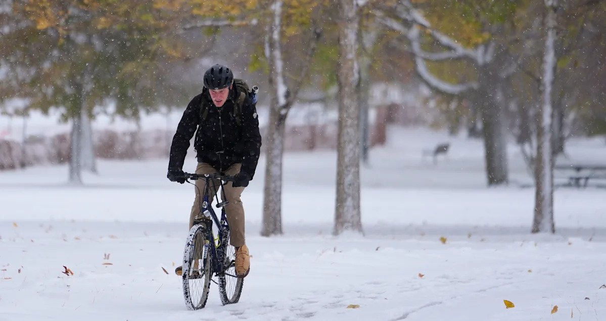
The first snows of the season started over the weekend in the Chicago area; by Monday, flurries were falling as fast as three inches per hour in Northwest Indiana and Michigan’s Upper Peninsula. Over a foot of snow had accumulated in the hardest hit places by Monday afternoon, with more expected to come overnight.
To put that in perspective, the first inch of snowfall accumulation at Chicago’s O’Hare International Airport typically occurs around Jan. 17 — more than two months from now.
“For some of the major metro areas in the Midwest and Great Lakes, this snow is coming way earlier than average,” said AccuWeather senior meteorologist Chad Merrill.
And the freeze isn’t stopping there. Forecasters expect additional accumulation across the snow belts of northeast Ohio, northwest Pennsylvania and southwest New York — with possible snow showers extending south into Kentucky, southern West Virginia, northern Tennessee and parts of the Carolinas early this week.
Meanwhile, Southeastern cities — Birmingham, Ala.; Baton Rouge, La.; Savannah, Ga. and even Jacksonville, Fla. — could wake up Tuesday morning to some of their coldest early-November temperatures in decades, with rare autumn freeze warnings in effect. Expect wind-chill lows in the upper 20s and highs cool enough to shatter seasonal records.
Melbourne, Fla., could see its earliest day below 60°F since record-keeping started there more than 85 years ago. Temperatures in Atlanta could plummet from 70°F on Sunday to 27°F by Tuesday morning. Winston-Salem and Charlotte, N.C., may experience a brief snow shower overnight Monday.
What’s causing this premature polar plunge? The confluence of two meteorological phenomena. The first is a frigid jet stream that has descended from Canada, effectively covering everything east of the Rockies. The second is what’s known as the “lake effect,” and it’s triggered by the first. After absorbing a lot of summer sunshine, the Great Lakes are still relatively warm this time of year. But when a mass of cold air suddenly passes over this much warmer water, it picks up moisture — then starts dumping it down in narrow bands of heavy snow as soon as the mass hits land.
Lake-effect snow typically falls within 25 miles of the shoreline but can extend to as far as 100 miles, according to the National Oceanic and Atmospheric Administration.
In Northwest Indiana and areas south of Chicago, double-digit snow totals and wind gusts up to 50 mph made for challenging conditions on Monday. Drivers were stranded on I-57. Dozens of schools were closed. Hundreds of flights were canceled.
The good news is that this week’s wintry preview won’t last long. As the jet stream retreats, temperatures across the central U.S. will rebound quickly on Tuesday, and most of the East will warm up again on Wednesday.