
Breaking News
Dangerous wildfire smoke hurting air quality as extreme heat and fire concerns grow
Heavy storms in the Carolinas brought between 1 to 4 inches of rain and prompted several flash flood warnings on Friday.
Near Nebo, North Carolina, three people were rescued and at least 25 others were evacuated from a campground due to rising floodwaters as some of the storms in the area were strong enough to produce scattered wind damage consisting of downed trees on roads and homes.
A neighborhood in Craven, South Carolina, also had several trees knocked down on homes, but there were no reports of injuries even though numerous homes suffered damage with some reported to be total losses.
The risk for flash flooding has now shifted Saturday to parts of the Southeast from Alabama to the Carolinas and into parts of northern Florida.
Heavy showers and thunderstorms are expected on Saturday and should continue into the evening with rainfall rates of 2 inches per hour possible with the heaviest downpours.
A small risk for flash flooding is also present for parts of the southern Appalachians, including Knoxville, Tennessee, and Dalton, Georgia, and some of these storms in the Southeast could be strong enough to produce isolated damaging winds and lightning.
There’s also a flash flooding risk for the Texas and Oklahoma panhandles, with heavy showers and thunderstorms later Saturday continuing into the evening as severe storms will also be possible for these areas, as well as stretching north to the Nebraska panhandle. Damaging winds, large hail and a few tornadoes will also be possible with these storms.
Elsewhere, wildfire smoke from Canada continues to blanket the Midwest, prompting alerts for millions for dangerous breathing conditions.
Air quality alerts are in effect for the entire states of Minnesota, Wisconsin, Michigan, Iowa and Illinois, as Chicago, Fort Wayne, Kansas City and Omaha are also under air quality alerts.
More than 700 wildfires are burning in Canada, with 216 labeled as “out of control” and 277 labeled as “monitored but out of control,” according to the Canadian Interagency Forest Fire Centre.

Bastien Inzaurralde/AFP via Getty Images – PHOTO: US-FIRE-ENVIRONMENT
Minneapolis and Chicago are once again seeing some of the worst air quality conditions in the world, with the air quality dipping down to “unhealthy” levels.
The worst of the smoke will be over Michigan, Minnesota and Wisconsin later on Saturday. However, hazy skies will be seen across much of the Midwest and some parts of the interior Northeast throughout the weekend.
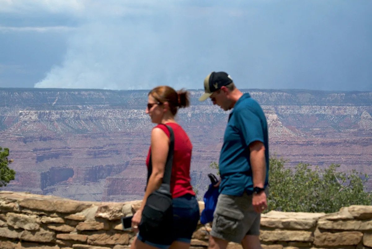
Active wildfires north of the Grand Canyon and in Utah are also creating hazy skies and, in some spots, poor air quality, though no air quality alerts are currently in effect for these areas.
The Dragon Bravo Fire along the north rim of the Grand Canyon National Park has burned over 112,000 acres and is only 9% contained as of Saturday morning.
Meanwhile, hot and dry conditions are persisting for parts of the West with several areas in the Southwest to watch for, either with extreme heat or fire weather concerns as an extreme heat warning is in effect for Phoenix and Tucson for high temperatures reaching between 110 and 115 this weekend through Tuesday.
An extreme heat watch is also in effect for these same areas for high temperatures possibly reaching up to 115 towards the end of next week.
Fire weather alerts are also up for parts of Utah and Colorado for relative humidity less than 10% and wind gusts between 25 and 35 mph.
The Monroe Canyon Fire, an active wildfire in Utah, has burned more than 55,000 acres and is only 5% contained as of Saturday as evacuation orders have been issued for the surrounding areas.
Notably, there are also fire weather concerns for parts of Hawaii, specifically the leeward portions of all Hawaiian Islands and interior sections of the Big Island as dry weather, as well as wind gusts between 35 and 50 mph, will persist through the weekend with conditions improving by late Sunday for the Hawaiian Islands.