
Breaking News
Bone-chilling Arctic cold to bring snow for some in central and eastern US before 2026 arrives
Arctic air means business this week with plunging temperatures from the Plains to the East Coast and Gulf Coast states. Accompanying the waves of Arctic air will be rounds of snow for some in the Midwest and Northeast, as well as heavy lake-effect snow around the Great Lakes.
The rounds of snow will continue long after the howling high winds ease up Tuesday.

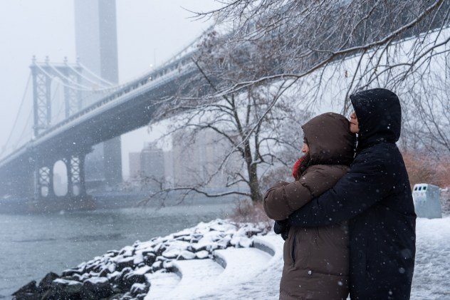
A couple embraces during a snow in front of the Manhattan Bridge, Sunday, Dec. 14, 2025, in the Brooklyn borough of New York. (AP Photo/Adam Gray)
Arctic air’s return delivers a reality check
As the leading edge of the Arctic air advanced, temperatures plummeted 40-60 degrees in a matter of several hours over portions of the Plains and the Mississippi Valley from Sunday to Monday morning.
For example, after a record high of 78 Sunday afternoon, people in St. Louis were greeted Monday morning with temperatures hovering at 15 and an AccuWeather RealFeel® Temperature of 12 below zero. That’s an actual temperature drop of 63 degrees Fahrenheit and a RealFeel® drop of 90 degrees.
On Monday, the temperature in Pittsburgh plummeted 42 degrees in 12 hours from 64 at 2 a.m. to 22 at 2 p.m., when the RealFeel Temperature was 7.

AccuWeather.com
The temperature drop along the Interstate-95 corridor will range from 20-30 degrees from one day to the next. AccuWeather RealFeel® Temperatures may be 10-30 degrees lower than the actual temperature when the wind is blowing and the sun is not out.
In most cases, the air will not be as severe as it was a few weeks ago in the Midwest and Northeast. However, factoring in the wind at times, it may feel about as cold or perhaps a bit colder for some.
Nighttime temperatures will dip below zero at times in parts of the Upper Midwest and the Northeast, with lows in the single digits, teens and 20s for most of the I-70 and I-80 corridors.

AccuWeather.com
From parts of Louisiana to Florida, temperatures may dip close to their lowest levels experienced in mid-November and mid-December, with a frost and freeze for portions of central Florida. Most areas over the interior Southern states will stop a few degrees short of those levels, but factoring in recent warmth, it will be a bit of a shock.
Clipper storms and lake-effect to bring snow and sudden whiteouts
In the wake of the powerful weekend storm, the rush of Arctic air across the open waters of the Great Lakes will create flurries, bands of lake-effect snow and snow squalls from Michigan to the Northeast through much of this week. Most of the lake-effect heavy snow bands will be confined to the northern part of I-81 in New York, I-75 and I-196 in Michigan and I-90 from New York to Indiana.

AccuWeather.com
A foot or two of snow can easily pile up from lake-effect snow alone this week, where bands persist or return for multiple rounds. Some areas in Michigan may end up with 48-60 inches of snow, counting the storm from this past weekend through the rounds of snow and lake-effect into Friday.
GET THE FREE ACCUWEATHER APP
Making the weather situation more complex will be a double-jointed clipper storm that will race along with two patches of snow.
In parts of Minnesota, Wisconsin and Michigan, as well as upstate New York and New England, two patches of snow may overlap.

AccuWeather.com
The circulation around the clipper storm will cause winds to shift, resulting in significant changes to the location of lake-effect bands from one day to the next.
Both patches could bring a couple of rounds of snow to Chicago from later Tuesday to Wednesday night. One round may bring a bit of snow to New York City from late Tuesday night to Wednesday, with a second round from late Wednesday to Wednesday night. This means there’s a significant chance of snow in the air at the stroke of midnight on New Year’s Eve in both cities and others.
It may be enough to make roads and sidewalks slippery in some locations outside of the lake effect from the Midwest to the Northeast.

AccuWeather.com
During the northwest winds in the wake of the big storm through Tuesday and in the wake of the clipper storm later this week, there is a likelihood of localized snow squalls that can extend hundreds of miles away from the shores of the Great Lakes. These will pose hazards for motorists on the interstates 70 and 80 corridors.
The snowy pattern will lead to airline delays related to deicing operations and slippery runways from the Midwest to the Northeast.
Want next-level safety, ad-free? Unlock advanced, hyperlocal severe weather alerts when you subscribe to Premium+ on the AccuWeather app. AccuWeather Alerts™ are prompted by our expert meteorologists who monitor and analyze dangerous weather risks 24/7 to keep you and your family safer.